The Île Interdite Property consists of 20 claims covering 1,089 hectares (10.9 km2) and extends over 5 km along the Nottaway River Shear Zone, a prominent regional structure that can be followed over 200 km.
Location: The Property is in Quebec’s James Bay region.
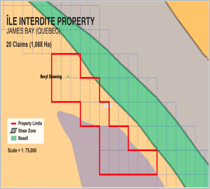
Île Interdite is near the contact between the Nemiscau Sedimentary and the Opatica Pluto-Volcanic Sub-Provinces, consisting of paragneiss and amphibolite rocks.
The Île Interdite Property hosts an important beryl showing that was identified in the 1960’s by the same group of Quebec government geologists who reported spodumene at both Whabouchi and Cyr deposit’s locations. Beryl is a relatively rare pathfinder mineral for lithium, often observed in pegmatites. At Île Interdite, beryl is disseminated in a pegmatite.
The Company completed remote sensing work in 2024 and outlined 14 potential pegmatite dykes.